
Category:Puget Sound
sound along the northwestern coast of the U.S. state of Washington .jpg) Пьюджет-Саунд | |||||
| Upload media | |||||
| Instance of | |||||
|---|---|---|---|---|---|
| Part of | |||||
| Named after |
| ||||
| Location | Washington, Pacific Northwest, Washington, Pacific States Region | ||||
| Connects with |
| ||||
| Has part(s) |
| ||||
| Width |
| ||||
| Length |
| ||||
| Area |
| ||||
| Inflows |
| ||||
| Tributary |
| ||||
 | |||||
For islands in Puget Sound, see Category:Islands of Washington (state)
Subcategories
This category has the following 56 subcategories, out of 56 total.
- Maps of Puget Sound (49 F)
A
B
C
- Charles Richey Sr. Viewpoint (72 F)
- Colvos Passage (20 F)
D
- Dash Point State Park (8 F)
E
H
K
- Kilisut harbour (1 F)
L
- Liberty Bay (41 F)
M
N
- National Ocean Survey 1894 (15 F)
P
- Point Wells (6 F)
- Port Townsend Bay (4 F)
Q
R
S
- Seahurst Park (19 F)
- Skagit Bay (1 P, 22 F)
- Southworth ferry terminal (12 F)
T
- Three Tree Point (16 F)
U
W
Media in category "Puget Sound"
The following 200 files are in this category, out of 376 total.
(previous page) (next page)-
_Shipping_first_cargo_of_halibut_caught_in_Puget_Sounds_by_crew_of_schooner_Oscar_an_-_NARA_-_513088.jpg/120px-%22N._P._Railway%2C_Tacoma_(Wash._Terr.)_Shipping_first_cargo_of_halibut_caught_in_Puget_Sounds_by_crew_of_schooner_Oscar_an_-_NARA_-_513088.jpg)
-

-
 20 1206 -1 98th St SW Dog Walker.jpg 4,608 × 3,456; 18.32 MB
-
 20 1206 -1 98th St SW Looking South 3.jpg 4,608 × 3,456; 9.99 MB
-
 20 1206 -1 98th St SW Photographers 2.jpg 4,101 × 3,204; 9.68 MB
-
 20 1206 -2 Brace Point Looking South.jpg 4,608 × 3,456; 12.49 MB
-
 20 1206 -2 Brace Point Whale Watchers.jpg 4,608 × 3,456; 12.26 MB
-
 20 1206 -4 Mother and Daughter.jpg 3,456 × 4,608; 15.48 MB
-
 20 1206 -4 Overlook.jpg 4,490 × 3,367; 16.26 MB
-
 20 1206 -4 SW Alaska St Seating Steps.jpg 4,558 × 3,419; 9.01 MB
-
 20 1206 -5 SW Carroll Street 2.jpg 4,074 × 3,022; 10.13 MB
-
 20 1206 -6 SW Andover Street Stair.jpg 3,915 × 2,937; 1.89 MB
-
 20 1206 -7 SW Spokane.jpg 4,560 × 3,420; 10.52 MB
-

-
 A sound sound by Coldpaws.jpeg 800 × 195; 30 KB
-

-
 Aerial of west Queen Anne, Seattle, 1969.jpg 1,200 × 967; 298 KB
-
 Aerial view of Discovery Park and Fort Lawton in Seattle.jpg 3,264 × 2,448; 2.67 MB
-
 Aerial view of Lummi Island.jpg 1,280 × 650; 71 KB
-
 Aerial view of prison - NARA - 299561.jpg 3,000 × 2,314; 1.61 MB
-
 Aerial view of West Point Treatment Plant, Seattle.jpg 886 × 602; 203 KB
-
.jpg/120px-Afternoon_View_(5225744113).jpg) Afternoon View (5225744113).jpg 3,888 × 2,592; 3.02 MB
Afternoon View (5225744113).jpg 3,888 × 2,592; 3.02 MB
-
 Airborne Over Seattle - Flickr - brewbooks.jpg 1,679 × 1,080; 1.17 MB
-
 Alki Beach pano 01A.jpg 8,840 × 1,415; 2.58 MB
-
.jpeg/120px-American_Gasoline_Co_plant_at_Richmond_Beach%2C_1914_(CURTIS_63).jpeg) American Gasoline Co plant at Richmond Beach, 1914 (CURTIS 63).jpeg 768 × 618; 77 KB
American Gasoline Co plant at Richmond Beach, 1914 (CURTIS 63).jpeg 768 × 618; 77 KB
-
_resulting_from_transport_of_dredged_material_and_disposal_at_Puget_Sound_Dredged_Disposal_Analysis_(PSDDA)_open-water_disposal_sites_-_USACE-p266001coll1-9070.pdf/page1-93px-thumbnail.pdf.jpg)
-
 Anderson Island and Puget Sound from Steilacoom.jpg 3,395 × 2,234; 6.28 MB
-
 Anderson Point County Park Beach Fort.jpg 1,021 × 1,024; 246 KB
-
_(18245871649).jpg/120px-Annual_report_of_the_Director_to_the_Board_of_Trustees_for_the_year_.._(1906)_(18245871649).jpg)
-
.jpg/120px-Anti-nuclear_bumper_sticker%2C_1970_(46315146565).jpg) Anti-nuclear bumper sticker, 1970 (46315146565).jpg 4,490 × 1,211; 1.7 MB
Anti-nuclear bumper sticker, 1970 (46315146565).jpg 4,490 × 1,211; 1.7 MB
-
.jpg/120px-Aquaculture_in_Rich_Passage_(48572384312).jpg) Aquaculture in Rich Passage (48572384312).jpg 4,928 × 3,264; 4.94 MB
Aquaculture in Rich Passage (48572384312).jpg 4,928 × 3,264; 4.94 MB
-
 Argus - A.Y.P. ed. - Page 49.jpg 5,532 × 4,315; 7.99 MB
-

-
 August Sunset from Chuckanut Drive.jpg 495 × 348; 52 KB
-
 Bainbridge Island - panoramio - Jan Walldén.jpg 1,600 × 1,200; 807 KB
-
 Bainbridge Island - panoramio.jpg 1,600 × 1,200; 667 KB
-
.jpg/120px-Bainbridge_Island_and_Puget_Sound_Sunset_Seattle_Washington_(19310023655).jpg) Bainbridge Island and Puget Sound Sunset Seattle Washington (19310023655).jpg 5,760 × 2,906; 10 MB
Bainbridge Island and Puget Sound Sunset Seattle Washington (19310023655).jpg 5,760 × 2,906; 10 MB
-
 Beach at Carkeek Park 01.jpg 6,000 × 4,000; 12.52 MB
-
 Beach southwest from Carkeek Park 01.jpg 6,000 × 4,000; 13.95 MB
-
_-_Flickr_-_Jitabebe.jpg/120px-Beautiful_Sunset_(Explored_N°_296_)_-_Flickr_-_Jitabebe.jpg) Beautiful Sunset (Explored N° 296 ) - Flickr - Jitabebe.jpg 4,288 × 2,848; 9.97 MB
Beautiful Sunset (Explored N° 296 ) - Flickr - Jitabebe.jpg 4,288 × 2,848; 9.97 MB
-
 Big soap bubble on the Edmonds, WA shore.jpg 6,000 × 4,000; 9.78 MB
-
 Blake Island in Puget Sound.jpg 2,203 × 1,369; 884 KB
-
 Bloedel Reserve 25.jpg 4,288 × 2,848; 4.08 MB
-
 BlueHillsWA-BowenVP.jpg 1,218 × 200; 47 KB
-
 BNSF Scenic Subdivision, from Carkeek Park overpass.jpg 800 × 600; 116 KB
-
 BNSF train in Steilacoom.jpg 3,805 × 2,805; 16.78 MB
-
.jpg/88px-Boats_docked_on_Puget_Sound%2C_Seattle%2C_1900_(MOHAI_670).jpg) Boats docked on Puget Sound, Seattle, 1900 (MOHAI 670).jpg 443 × 600; 46 KB
Boats docked on Puget Sound, Seattle, 1900 (MOHAI 670).jpg 443 × 600; 46 KB
-
 Boston Harbor and Marina, Boston Harbor, Washington.jpg 4,510 × 2,975; 4.82 MB
-
 Boston Harbor Marina, Boston Harbor, Washington.jpg 3,264 × 2,448; 3.49 MB
-
 Bremerton Washington Marina.jpg 1,024 × 1,024; 190 KB
-
 Buoy in Puget Sound.jpg 6,000 × 4,000; 14.12 MB
-
 Burton, WA 05.jpg 4,288 × 2,848; 4.95 MB
-
.jpeg/120px-Cabin_aboard_the_four-masted_British_bark_LYNTON%2C_Puget_Sound%2C_Washington%2C_ca_1904_(HESTER_310).jpeg)
-
 Cama Beach State Park south view.jpg 2,272 × 1,569; 1.17 MB
-
 Cama Beach State Park view north.jpg 2,084 × 1,489; 837 KB
-
 CamanoSHores-MtRainier.jpg 2,048 × 1,536; 442 KB
-
_(30726945752).jpg/120px-Capitella_capitata_(Fabricius_1780)_(30726945752).jpg) Capitella capitata (Fabricius 1780) (30726945752).jpg 1,824 × 1,368; 133 KB
Capitella capitata (Fabricius 1780) (30726945752).jpg 1,824 × 1,368; 133 KB
-
.jpeg/120px-Captain_FH_Henning_and_the_crew_of_the_three-masted_ship_STRONSA_taken_on_deck%2C_Puget_Sound_port%2C_Washington%2C_ca_1904_(HESTER_136).jpeg)
-
 Carkeek Park north meadow 01.jpg 2,592 × 1,944; 858 KB
-
 Carkeek Park north meadow 02.jpg 2,592 × 1,944; 1.15 MB
-
 Carkeek Park shore looking north 01.jpg 2,592 × 1,944; 968 KB
-
 Carkeek Park shore looking north 02.jpg 2,592 × 1,944; 1.92 MB
-
 Carkeek Park shore looking south 01.jpg 2,592 × 1,944; 2.24 MB
-
 Carr Inlet 01.jpg 4,288 × 2,848; 4.67 MB
-
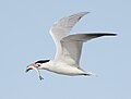
 Caspian Tern 2444v.jpg 2,387 × 1,743; 1.44 MB
-
 Caspian Tern 2705v.jpg 2,277 × 1,790; 1.63 MB
-
 Caspian Tern 2706v.jpg 1,838 × 1,396; 987 KB
-
 Caspian Tern 6841v.jpg 1,464 × 1,114; 1.09 MB
-
 Caspian Tern 6844v.jpg 2,750 × 1,983; 2.98 MB
-
 Caspian Tern 6878v.jpg 2,377 × 1,828; 2.95 MB
-
 Caspian Tern 6909v.jpg 1,433 × 1,153; 1.03 MB
-
 Caspian Tern 6922v.jpg 2,528 × 1,997; 3.39 MB
-
.jpg/73px-Charles_Crocket_of_Whidbey_Island%2C_Washington%2C_ca_1870_(PORTRAITS_612).jpg)
-
.jpg/80px-Clinton_Beach%2C_Washington_State_(May_25%2C_2007).jpg) Clinton Beach, Washington State (May 25, 2007).jpg 2,304 × 3,456; 1.38 MB
Clinton Beach, Washington State (May 25, 2007).jpg 2,304 × 3,456; 1.38 MB
-
.jpeg/120px-Crew_on_the_deck_of_the_four-masted_British_bark_LYNTON%2C_Puget_Sound_port%2C_Washington%2C_ca_1904_(HESTER_27).jpeg)
-
 Cultus Bay 357.jpg 3,456 × 2,304; 2.16 MB
-
.jpg/120px-David_and_Carrie_Rodgers’_farm_in_Zenith%2C_Washington%2C_ca_1920_(MOHAI_4437).jpg)
-

-
 Deception Pass bridge on Puget Sound between Whidbey and Fidalgo Islands - panoramio.jpg 2,695 × 1,495; 1.3 MB
-

-
.jpg/120px-Deception_Pass_on_Puget_Sound_between_Whidbey_and_Fidalgo_Islands_-_panoramio_(1).jpg) Deception Pass on Puget Sound between Whidbey and Fidalgo Islands - panoramio (1).jpg 3,264 × 2,448; 2.26 MB
Deception Pass on Puget Sound between Whidbey and Fidalgo Islands - panoramio (1).jpg 3,264 × 2,448; 2.26 MB
-
 Deception Pass on Puget Sound between Whidbey and Fidalgo Islands - panoramio.jpg 3,252 × 2,434; 2.01 MB
-
 Deception Pass on Puget Sound between Whidbey and Fidalgo Islandsand - panoramio.jpg 3,264 × 2,448; 2.06 MB
-
 Deception Pass, Puget Sound, Washington State - panoramio.jpg 2,925 × 1,879; 3.63 MB
-
-
 Des Moines StarShine.jpg 572 × 688; 53 KB
-
 Des Moines, WA from Marine View Park.jpg 3,264 × 2,448; 2.14 MB
-
 Des Moines, WA from Point Robinson 01.jpg 4,288 × 2,848; 5.23 MB
-
 Des Moines, WA from Point Robinson 02.jpg 4,288 × 2,848; 4.34 MB
-
 Des Moines, WA marina pier with Olympic Mountains.jpg 2,012 × 650; 333 KB
-
.jpg/120px-Des_Moines%2C_Washington_with_Puget_Sounds_and_Maury_and_Vashon_Island_(1291262691).jpg) Des Moines, Washington with Puget Sounds and Maury and Vashon Island (1291262691).jpg 1,600 × 1,200; 185 KB
Des Moines, Washington with Puget Sounds and Maury and Vashon Island (1291262691).jpg 1,600 × 1,200; 185 KB
-
.jpg/120px-Des_Moines%2C_Washington_with_Puget_Sounds_and_Maury_and_Vashon_Island_(1292124062).jpg) Des Moines, Washington with Puget Sounds and Maury and Vashon Island (1292124062).jpg 1,600 × 1,200; 189 KB
Des Moines, Washington with Puget Sounds and Maury and Vashon Island (1292124062).jpg 1,600 × 1,200; 189 KB
-
.jpg/120px-Discovery_Park_and_Puget_Sound_(22988023391).jpg) Discovery Park and Puget Sound (22988023391).jpg 4,288 × 2,848; 7.53 MB
Discovery Park and Puget Sound (22988023391).jpg 4,288 × 2,848; 7.53 MB
-
 Discovery Park Cookout - panoramio.jpg 3,072 × 2,304; 2.34 MB
-
 Discovery Park Overlook, Seattle, WA - panoramio.jpg 2,960 × 1,050; 1.54 MB
-
 Discovery Park, Seattle pano 01.jpg 7,144 × 2,136; 2.56 MB
-
.jpg/120px-Dock_with_sheds%2C_Puget_Sound%2C_between_1915_and_1925_(WASTATE_3519).jpg)
-
 Dockton, WA 03.jpg 4,288 × 2,848; 5.99 MB
-
 Downtown Seattle seen from Bainbridge Island.jpg 4,199 × 2,775; 1.84 MB
-
.jpg/120px-Downtown%2C_Queen_Anne%2C_and_Beyond_from_Columbia_Center_(3793785397).jpg) Downtown, Queen Anne, and Beyond from Columbia Center (3793785397).jpg 3,888 × 2,592; 2.9 MB
Downtown, Queen Anne, and Beyond from Columbia Center (3793785397).jpg 3,888 × 2,592; 2.9 MB
-
.jpg/120px-Downtown%2C_Queen_Anne%2C_and_Magnolia_from_Columbia_Center_(3794607902).jpg) Downtown, Queen Anne, and Magnolia from Columbia Center (3794607902).jpg 3,888 × 2,592; 3.13 MB
Downtown, Queen Anne, and Magnolia from Columbia Center (3794607902).jpg 3,888 × 2,592; 3.13 MB
-
 Driftwood on Fox Island.jpg 1,704 × 1,943; 834 KB
-
 Driftwood Shores Camano Island.jpg 2,272 × 1,507; 630 KB
-
 Duwamish Head from Seattle Columbia Center.jpg 410 × 254; 74 KB
-
_(2).jpg/120px-Edmond_Ferry_(5652059941)_(2).jpg) Edmond Ferry (5652059941) (2).jpg 4,752 × 3,168; 4.67 MB
Edmond Ferry (5652059941) (2).jpg 4,752 × 3,168; 4.67 MB
-
 Edmonds Ferry from Edmonds Beach - Edmonds Washington.jpg 3,986 × 2,166; 2.37 MB
-
 Edmonds Ferry, Olympic Mountains.jpg 4,752 × 3,168; 5.14 MB
-
 Edmonds, Washington from ferry dock pano 01.jpg 7,123 × 1,579; 3.8 MB
-
 Edmonds, Washington from ferry dock pano 02.jpg 8,016 × 1,752; 3.93 MB
-
 Edmonds, Washington from ferry dock pano 03.jpg 8,024 × 1,576; 3.93 MB
-
 Edmonds, Washington from the water 01.jpg 4,288 × 2,848; 4.49 MB
-
.jpg/120px-Emptying_a_salmon_trap%2C_ca_1910_(MOHAI_6170).jpg) Emptying a salmon trap, ca 1910 (MOHAI 6170).jpg 963 × 700; 103 KB
Emptying a salmon trap, ca 1910 (MOHAI 6170).jpg 963 × 700; 103 KB
-
 EVERETT AND ITS HARBOR ON PUGET SOUND - NARA - 552133.jpg 3,000 × 2,035; 861 KB
-
 Extreme low tide at Charles Richey Sr. Viewpoint 01.jpg 6,000 × 4,000; 13.64 MB
-
 Fauntleroy Cove and Brace Point.jpg 2,190 × 1,704; 849 KB
-
 Fay Bainbridge Park, Washington, USA.JPG 4,320 × 3,240; 1.17 MB
-
 Fay Bainbridge State Park, Washington, USA.JPG 4,320 × 3,240; 1.84 MB
-
.jpg/117px-February_2%2C_2012_Puget_Sound%2C_plumose_anemone_(6988302287).jpg) February 2, 2012 Puget Sound, plumose anemone (6988302287).jpg 998 × 1,024; 492 KB
February 2, 2012 Puget Sound, plumose anemone (6988302287).jpg 998 × 1,024; 492 KB
-
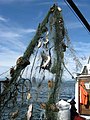
.jpg/120px-February_6%2C_2013_A_murky_scene_of_abandoned_fishing_nets%2C_Puget_Sound_(8514569790).jpg) February 6, 2013 A murky scene of abandoned fishing nets, Puget Sound (8514569790).jpg 4,608 × 3,456; 1.87 MB
February 6, 2013 A murky scene of abandoned fishing nets, Puget Sound (8514569790).jpg 4,608 × 3,456; 1.87 MB
-
.jpg/120px-February_6%2C_2013_EPA_Divers_help_with_abandoned_fishing_gear_in_Puget_Sound_(8514569738).jpg) February 6, 2013 EPA Divers help with abandoned fishing gear in Puget Sound (8514569738).jpg 4,608 × 3,456; 1.87 MB
February 6, 2013 EPA Divers help with abandoned fishing gear in Puget Sound (8514569738).jpg 4,608 × 3,456; 1.87 MB
-
 Federal Way, Puget Sound, Washington.jpg 2,304 × 1,728; 2.61 MB
-
.jpg/120px-Ferry_under_Baker_(16297884803).jpg) Ferry under Baker (16297884803).jpg 3,785 × 1,850; 4.17 MB
Ferry under Baker (16297884803).jpg 3,785 × 1,850; 4.17 MB
-
.jpeg/120px-Fish_caught_in_fish_trap%2C_Puget_Sound%2C_1917_(COBB_180).jpeg) Fish caught in fish trap, Puget Sound, 1917 (COBB 180).jpeg 768 × 512; 102 KB
Fish caught in fish trap, Puget Sound, 1917 (COBB 180).jpeg 768 × 512; 102 KB
-
.jpg/120px-Fishing_boats_at_a_dock%2C_Puget_Sound%2C_between_1915_and_1925_(WASTATE_3525).jpg)
-
 Floating aquaculture in Puget Sound 01.jpg 4,288 × 2,848; 4.1 MB
-
 Floating aquaculture in Puget Sound 02.jpg 4,288 × 2,848; 4.38 MB
-
-
 FMIB 32773 Fishing a Trap on Puget Sound.jpeg 750 × 624; 168 KB
-
 FMIB 33810 Fishing a Salmon Trap, Puget Sound.jpeg 724 × 572; 100 KB
-
 FMIB 34414 Puget Sound Cannery.jpeg 1,015 × 552; 99 KB
-
 FMIB 34521 Puget Sound Salmon Trap.jpeg 650 × 294; 24 KB
-
 FMIB 42040 Seed Oysters from New York, Unloading at Puget Sound.jpeg 1,269 × 910; 286 KB
-
 FMIB 44386 Salmon Traps on Puget Sound.jpeg 1,011 × 817; 376 KB
-

-
 Fox Island and Tacoma Narrows 01.jpg 4,288 × 2,848; 4.31 MB
-
 Framed view of Blake Island 1.jpg 800 × 433; 84 KB
-
 Framed view of Blake Island.jpg 800 × 419; 92 KB
-

-
 Golden Gardens - panoramio.jpg 800 × 600; 100 KB
-
.jpg/120px-Golden_Gardens_2014-03-22_21_(13365416153).jpg) Golden Gardens 2014-03-22 21 (13365416153).jpg 4,288 × 2,848; 6.68 MB
Golden Gardens 2014-03-22 21 (13365416153).jpg 4,288 × 2,848; 6.68 MB
-
.jpg/120px-Golden_Sound_(2844159681).jpg) Golden Sound (2844159681).jpg 1,024 × 410; 129 KB
Golden Sound (2844159681).jpg 1,024 × 410; 129 KB
-
.jpg/120px-Grennan_%26_Cranney%27s_Saw_Mills%2C_Utsalady%2C_Camano_Island%2C_Puget_Sound%2C_W_T%2C_1862_(MAPS_71).jpg) Grennan & Cranney's Saw Mills, Utsalady, Camano Island, Puget Sound, W T, 1862 (MAPS 71).jpg 8,179 × 5,057; 8.89 MB
Grennan & Cranney's Saw Mills, Utsalady, Camano Island, Puget Sound, W T, 1862 (MAPS 71).jpg 8,179 × 5,057; 8.89 MB
-
 Hammersley Inlet and Oakland Bay.jpg 1,512 × 1,911; 906 KB
-
 Harbor Seal DSC 3652a.jpg 3,703 × 2,624; 3.29 MB
-
 Harbor Seal DSC 3705a.jpg 6,016 × 4,016; 3.96 MB
-
 Harbor Seal DSC 3763a.jpg 5,046 × 3,364; 3.61 MB
-
 Homes on the Puget Sound, ca. 1910 - DPLA - b0405cfc7dcdaaf065431849ff0288d0.jpg 8,669 × 6,265; 2.34 MB
-
 Hop Pickers - Puget Sound LACMA AC1997.247.6.jpg 449 × 640; 127 KB
-
 Illustration from Rose Lodge calendar, 1910.jpg 2,269 × 1,030; 1.62 MB
-
 Inflatable boat off of West Seattle shore.jpg 4,288 × 2,848; 5.1 MB
-
 ISS058-E-11009 - View of Puget Sound.jpg 5,568 × 3,712; 2.08 MB
-
 Juan de Fuca Strait.JPG 800 × 600; 48 KB
-
 Kingston view of Sound.jpg 4,032 × 3,024; 1.05 MB
-
 Kingston, WA - shore of cove 01.jpg 4,288 × 2,848; 5.11 MB
-
 Kingston, WA at dusk from docked ferry - pano.jpg 6,668 × 1,757; 3.66 MB
-
 Kopachuck Panorama.jpg 14,022 × 1,525; 8.12 MB
-
 KOPACHUK STATE PARK BEACH AT GIG HARBOR IN SOUTHERN PUGET SOUND - NARA - 552295.jpg 3,000 × 2,017; 660 KB
-
 Lakebay Marina, Washington State.jpg 1,199 × 1,799; 462 KB
-
 Lincoln Park in West Seattle.jpg 2,272 × 1,054; 1.76 MB
-
_(14761409702).jpg/87px-Locomotive_engineering_-_a_practical_journal_of_railway_motive_power_and_rolling_stock_(1897)_(14761409702).jpg)
-
 LOG BOOMS IN SOUTHERN PUGET SOUND, WASHINGTON. NEAR SEATTLE - NARA - 555155.jpg 2,000 × 1,360; 628 KB
-
 Lonley Man at Puget Sound.jpg 1,935 × 1,450; 2.36 MB
-
 Looking SW across Budd Inlet from Burfoot Park.jpg 4,032 × 3,024; 4.1 MB
-
 Looking to the stern - panoramio.jpg 3,264 × 2,448; 2.06 MB
-
.jpeg/94px-Lowering_the_beam_trawl_on_the_steamship_ALBATROSS_in_Puget_Sound%2C_June_1914_(COBB_67).jpeg)
-
 Magnolia - panoramio.jpg 1,599 × 1,199; 469 KB
-
 Magnolia Sunset - panoramio.jpg 3,264 × 2,448; 449 KB
-
 ManchesterWashingtonWaterfront.JPG 1,000 × 648; 147 KB
-
.jpg/120px-Map_of_Waterway_Connecting_Puget_Sound_with_Lakes_Union_and_Washington%2C_Index%2C_February_1905_(MOHAI_13400).jpg)
-
 Map-of-washington-state-showing-puget-sound-area.png 221 × 136; 3 KB
-
.jpg/120px-Mapping_eel_grass_beds_in_Eagle_Harbor_(4952396946).jpg) Mapping eel grass beds in Eagle Harbor (4952396946).jpg 640 × 480; 72 KB
Mapping eel grass beds in Eagle Harbor (4952396946).jpg 640 × 480; 72 KB
-
.jpg/120px-March_27%2C_2013_-_Small_crab_stuck_in_‘ghost_nets’_on_Puget_Sound_seafloor_(8678586448).jpg) March 27, 2013 - Small crab stuck in ‘ghost nets’ on Puget Sound seafloor (8678586448).jpg 2,048 × 1,536; 1.72 MB
March 27, 2013 - Small crab stuck in ‘ghost nets’ on Puget Sound seafloor (8678586448).jpg 2,048 × 1,536; 1.72 MB
-
 Masonic Retirement Center of Washington cherry trees 02.jpg 3,264 × 2,448; 2.13 MB
-
 Maury Island from Redondo, Des Moines, Washington.jpg 4,288 × 2,848; 4.1 MB
-
 MaxBchMtns.jpg 443 × 339; 33 KB
-
 McNeil Island 01.jpg 4,288 × 2,848; 4.38 MB
-
 McNeil Island and neighbors, Washington.jpg 1,280 × 775; 137 KB
-
 McNeil Island Prison 01.jpg 4,288 × 2,848; 3.65 MB
-
 MeKwaMooks 102323.jpg 1,872 × 1,054; 556 KB
-
.jpg/77px-Moonlight_on_Puget_Sound%2C_ca._1920_-_DPLA_-_1f1f9ebff2a8d5ce6fccedc58f700d75_(page_1).jpg)
-
.jpg/120px-Moonlight_on_Puget_Sound%2C_Washington%2C_circa_1889-1891_(BOYD+BRAAS_140).jpg)
-
.jpg/77px-Moonlight_on_water%2C_ca._1925_-_DPLA_-_6ce8fc9767dcbbec3cbcde043eba7406_(page_1).jpg) Moonlight on water, ca. 1925 - DPLA - 6ce8fc9767dcbbec3cbcde043eba7406 (page 1).jpg 2,200 × 3,409; 832 KB
Moonlight on water, ca. 1925 - DPLA - 6ce8fc9767dcbbec3cbcde043eba7406 (page 1).jpg 2,200 × 3,409; 832 KB
-
 Mount Constance seen from Des Moines marina.jpg 2,251 × 1,393; 751 KB
-
.jpg/120px-Mount_Rainier_(4228576190).jpg) Mount Rainier (4228576190).jpg 2,816 × 2,112; 1.12 MB
Mount Rainier (4228576190).jpg 2,816 × 2,112; 1.12 MB
-
 Mount Rainier from Pudget Sound.jpg 3,024 × 4,032; 1.5 MB
-
 Mount Rainier peak with Puget Sound in the foreground 2.jpg 6,000 × 4,000; 17.2 MB
-
 Mount Rainier peak with Puget Sound in the foreground.jpg 6,000 × 4,000; 18.67 MB
-
.jpg/120px-Mount_Rainier_Sunrise_(4952397646).jpg) Mount Rainier Sunrise (4952397646).jpg 3,264 × 2,448; 1.85 MB
Mount Rainier Sunrise (4952397646).jpg 3,264 × 2,448; 1.85 MB
-
 Mount Rainier viewed from Puget Sound, May 2013.jpg 3,456 × 2,304; 2.64 MB
-
 Mt Baker through Obstruction Pass.jpg 2,560 × 1,648; 3.67 MB
-
.jpg/120px-Mt._Rainier_and_Puget_Sound%2C_ca._1915_-_DPLA_-_e2a31d06210770f49bd16997e0ac4629_(page_1).jpg)
-
 MV Puyallup approaching Edmonds 01.jpg 6,000 × 4,000; 11 MB
-
 No Beach Access Sign.jpg 1,024 × 683; 145 KB
-
.tiff/lossy-page1-78px-A_Glimpse_of_the_Sound_from_near_Seattle%2C_Seattle%2C_Wash_(NYPL_b12647398-68894).tiff.jpg) A Glimpse of the Sound from near Seattle, Seattle, Wash (NYPL b12647398-68894).tiff 1,549 × 2,392; 10.61 MB
A Glimpse of the Sound from near Seattle, Seattle, Wash (NYPL b12647398-68894).tiff 1,549 × 2,392; 10.61 MB
-
 Olympic Mountains - Flickr - brewbooks.jpg 3,264 × 1,778; 1.75 MB
-
 Olympic Mountains from Fox Island.jpg 2,272 × 1,704; 605 KB
-
 Olympic Mountains-1.jpg 4,608 × 3,072; 1.65 MB
-
 Olympic Mountains-2.jpg 4,608 × 3,072; 1.79 MB
-
.jpg/120px-Olympic_Peninsula_with_Puget_Sound_by_Sentinel-2%2C_2018-09-28_(big_version).jpg) Olympic Peninsula with Puget Sound by Sentinel-2, 2018-09-28 (big version).jpg 24,271 × 21,933; 632.77 MB
Olympic Peninsula with Puget Sound by Sentinel-2, 2018-09-28 (big version).jpg 24,271 × 21,933; 632.77 MB
-
.jpg/120px-Olympic_Peninsula_with_Puget_Sound_by_Sentinel-2%2C_2018-09-28_(small_version).jpg) Olympic Peninsula with Puget Sound by Sentinel-2, 2018-09-28 (small version).jpg 12,142 × 10,972; 154.17 MB
Olympic Peninsula with Puget Sound by Sentinel-2, 2018-09-28 (small version).jpg 12,142 × 10,972; 154.17 MB
_Shipping_first_cargo_of_halibut_caught_in_Puget_Sounds_by_crew_of_schooner_Oscar_an_-_NARA_-_513088.jpg)


.jpg)

.jpeg)


_(18245871649).jpg)
.jpg)


.jpg)


_-_Flickr_-_Jitabebe.jpg)


.jpg)


.jpeg)


_(30726945752).jpg)
.jpeg)


.jpg)
.jpg)
.jpeg)

.jpg)


.jpg)


.jpg)
.jpg)
.jpg)

.jpg)


.jpg)
.jpg)


_(2).jpg)


.jpg)
.jpg)
.jpg)

.jpg)
.jpeg)
.jpg)


.jpg)
.jpg)


_(14761409702).jpg)


.jpeg)


.jpg)

.jpg)
.jpg)


.jpg)
.jpg)
.jpg)

.jpg)


.jpg)


.jpg)


.jpg)
.jpg)
.jpg)
.jpg)
.jpg)